Kathmandu. Everest, the world’s highest peak, has risen in height. The new height of the highest peak is 8848.86 meters.

Nepal and China jointly announced new heights through a virtual program on Tuesday. After this announcement, the most used number ‘8848 meters’ for six and a half decades has now become history.
How did you suddenly come up with the idea of measuring the height of Mount Everest? Finding the answer to this question leads to the catastrophic earthquake of 2072.

A few weeks after the epicenter of the Barpak earthquake, which claimed the lives of about 9,000 people, the Department of Surveying and Mapping made public the fact that the Kathmandu Valley had shifted about 1.5 meters south. Kumari of Nagarkot, Swayambhu, Phulchowki, Bungamati and Nuwakot were measured as control points.
The control point of Nagarkot has been shifted 1.82 meters to the southwest and the height has been increased by 1.15 meters, the department announced. By this time, rumors had spread that the height of Mount Everest had fluctuated.
At the same time, on the occasion of the 250th anniversary of his Survey of India, the Surveyor General of India announced to measure the height of Everest. The Surveyor General had said that the height measured by the Survey of India in 1954 would be 8848 meters.
Then again there was a debate about how India started measuring the height of Mount Everest without the permission of the Nepali government. On 13 March 2073, while taking charge of the Survey Department, the newly appointed Director General Ganesh Prasad Bhat declared that Nepal itself was capable of measuring Everest.
A 12-member committee was formed under Bhatt’s chairmanship. Among them were Sureshman Shrestha, Niraj Manandhar, Mohammad Savir Hussain, Punya Vikram Poudel, Shivahari Koirala, Pravin Man Pradhan, Anil Marasini, Damodar Dhakal, Nirmal Kumar Acharya, Rishi Ram Shrestha and Sushil Dangol.
In the Fiscal Year 2074/075, the government allocated Rs. 20 million for measuring the height of Everest. After that, it was easy to formally move the program forward, says Bhatt.
“Then we called a conference of all the people who have measured Mt. Everest in the past,” says Bhatt.
73 cm or 86 ?
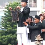
The two countries on Tuesday formally declared the height of Mount Everest at 8848.86 meters. After the dispute over the height of Mount Everest in 2010, Nepal and China have agreed to recognize 8848 meters.
Before that, there was a dispute of 4 meters between Nepal and China. The two countries have been at loggerheads since 2005 over whether to consider snow-covered heights as a basis for rock heights. According to the agreement, China is ready to determine the height based on the snow level.

China, on the other hand, has been measuring the height of Mount Everest at various times. Earlier in 1975, the Chinese Survey Department had declared the height of Everest to be 8848.13 meters. Based on that, it seems that it has increased by 73 cm instead of 86 cm.
Then, in 2005, the Chinese government announced that the height of Mount Everest was 8,844.43 meters above sea level. Both of these heights were measured by rocks, but the Government of Nepal disagreed.
For the first time, it was measured on its own initiative
Countries including India and China had offered assistance for measuring Everest. However, Nepal decided to measure on its own without the help of anyone. Even though the highest peak in the world falls on its own territory, Nepal itself had not had the opportunity to measure it before.
Recently, the Department of Surveying and Mapping has determined the height of Everest using its own resources, tools and technology. Former Deputy Director General of the Survey Department Sureshman Shrestha, who has been involved in measuring Everest from the very beginning, says that measuring the height of the highest peak is also linked to national pride.
“The new height is a historic achievement. At the same time, our manpower survey has proved that it has succeeded in giving the final result by processing the data,” says Shrestha.
Joint measurement and declaration
There is no doubt about the height of Mount Everest and its authenticity has been confirmed. Analysts are of the opinion that even if Nepal and China measure in their own way, its credibility will increase after reaching the same height. The northern part of Mount Everest is in Tibet, an autonomous region of China.
During the visit of Chinese President Xi Jinping to Nepal in October last year, a memorandum of understanding was signed to jointly declare the height of Mount Everest. Following the agreement, the Chinese side re-measured Mount Everest.
Speaking on the occasion, Foreign Minister Pradip Kumar Gyawali said, “We have agreed to jointly declare the height so that the new height is authentic and does not raise any question.”
Two hours on the highest peak
The data obtained from the field survey has been processed by the Survey Department. However, the department said that discussions were also held at the level of Chinese counterpart technical and steering committee.
The Nepali team reached the summit of Everest on 3 June 2076 at 3 pm. On that day, Rabin Karki and Chiringjangbu Sherpa, two assistant Sherpas led by Chief Survey Officer Khimlal Gautam, reached the summit.
“We spent two hours on the summit of the highest peak to do the most challenging task of measuring,” said Gautam, the chief survey officer.
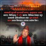
The government on Tuesday honored 120 people involved in various ways. Gautam, who has climbed Mt. Everest for the second time, says, “Don’t call it a personal success, it is possible through collective effort, it is really the success of all Nepalis.”